Party (7):
Alex Motyka (organiser), Kirstie Wulf/Shelter, Phillip (Phil) Clegg, Yogi (Yogeeta), Jesse Bram Sernig, Min Jie Lin, and I
I didn’t really have anything planned for the weekend so thought I’d come down to do something in the Maquarie pass area. It was more of a training day descending a series of waterfalls called The Cascades. I’d never actually been there before, so it seemed like another reason. And probably another canyon the day after.
Finishing work at Mt Banks early gave me plenty of time to pack. Kirstie has agreed to let me car pool with her. I could then camp somewhere and get a lift with someone to a train station to get back into he mountains.
Leaving home at 5am I arrived at Kirstie’s about an hour later (after almost knocking on the wrong house). It was about 2.5hrs further to the start of The Cascades walk. I ate my yoghurt in the car, trying to fulfil my passengers duty of keeping the driver awake with conversation 😉
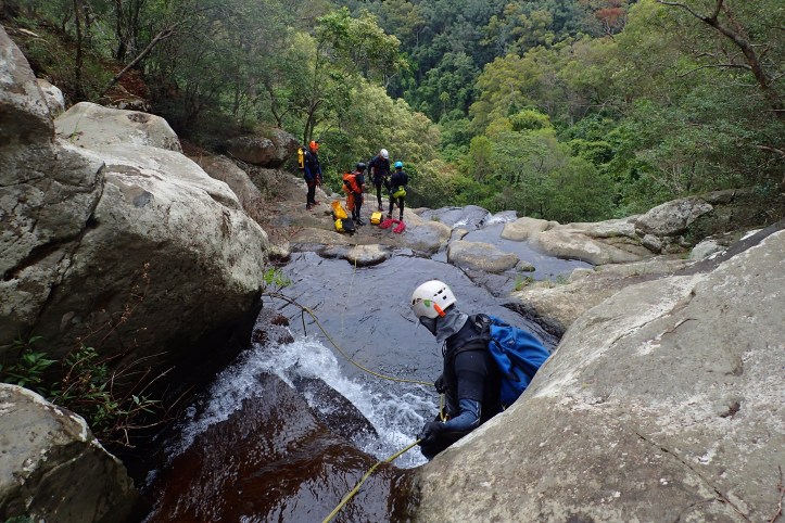
A little late, we found the others and got all the gear together. We had a little discussion about gear and canyon safety. I hoped Alex didn’t mind when I occasionally interjected. It was then a hop, jump and a skip to the bottom falls which is where most ppl walk to. Crossing the stream via some stepping stones, an obvious track continued up the other bank. It was steep and slippery and looked like it might be officially closed as we passed a ‘track closed’ sign. Running parallel to the stream we could see many of the waterfalls we’d be descending later in the day. Almost reaching the firetail I noticed many large stumps from the extensive logging that occurred in the area from the 1880s to 1960s. The route starts when you encounter the second «track closed sign».
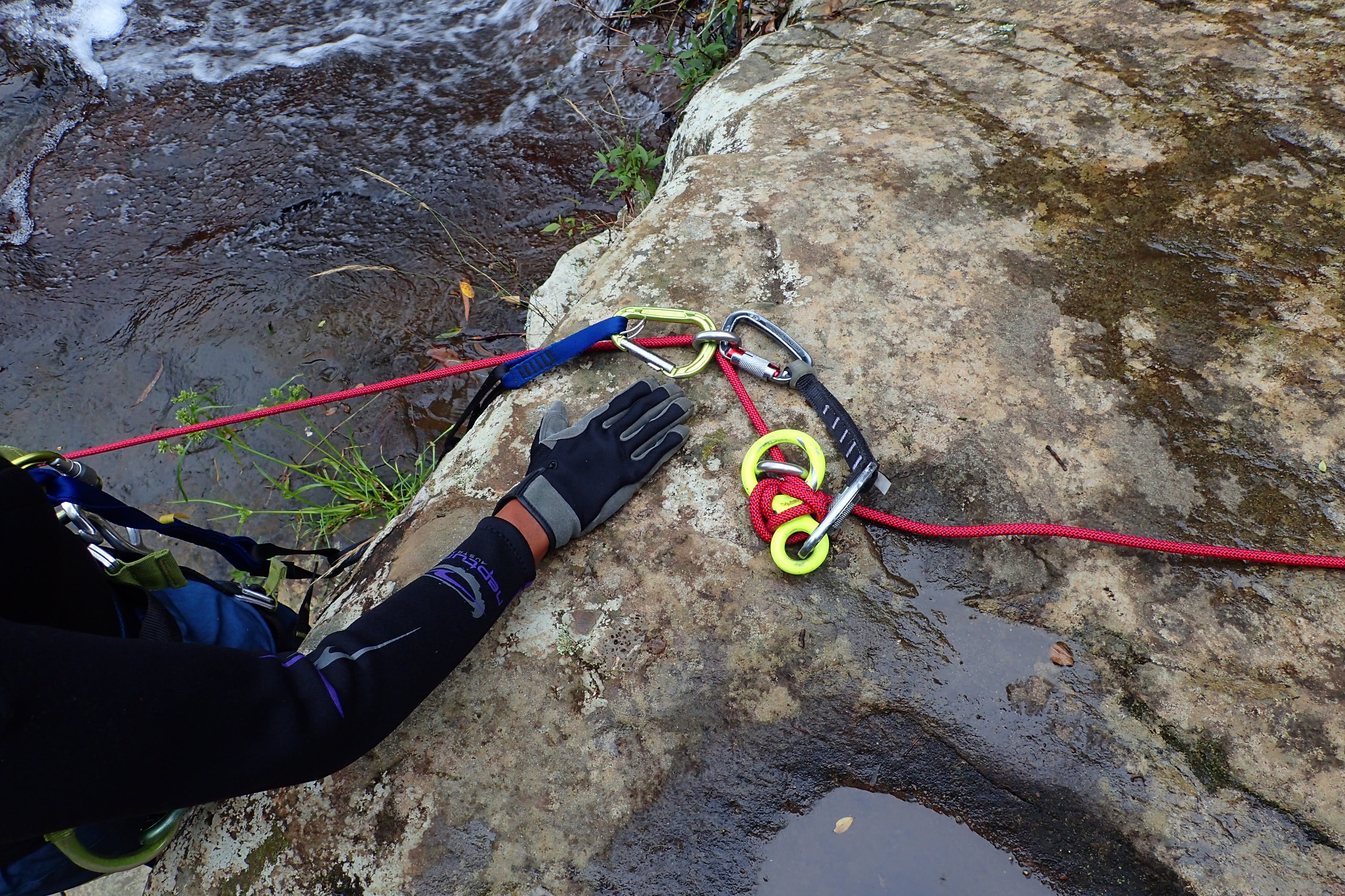
We dumped our packs and Alex began running through some basics and then the focus of the day: releasable anchors. The munter mule was what I’ve normally used in the past. We looked at using the:
- Gigi – surprisingly easy to set up. Similar to using the ATC guide. Also see the Jester.
- Kong Full – similar to the Gigi, but more of a rigging plate look.
- Figure 8 block – basically a locked off 8 acting as a biner block. But the eight can be released.
- Totem and Joker – similar to a figure 8 block but one rope on either side.
- Munter mule – minimal gear (prob why it has been my go-to) but only works in one direction.
Jesse had some unique ways of tying some knots because of his fishing background. I need to look again how he did the double fishermans.
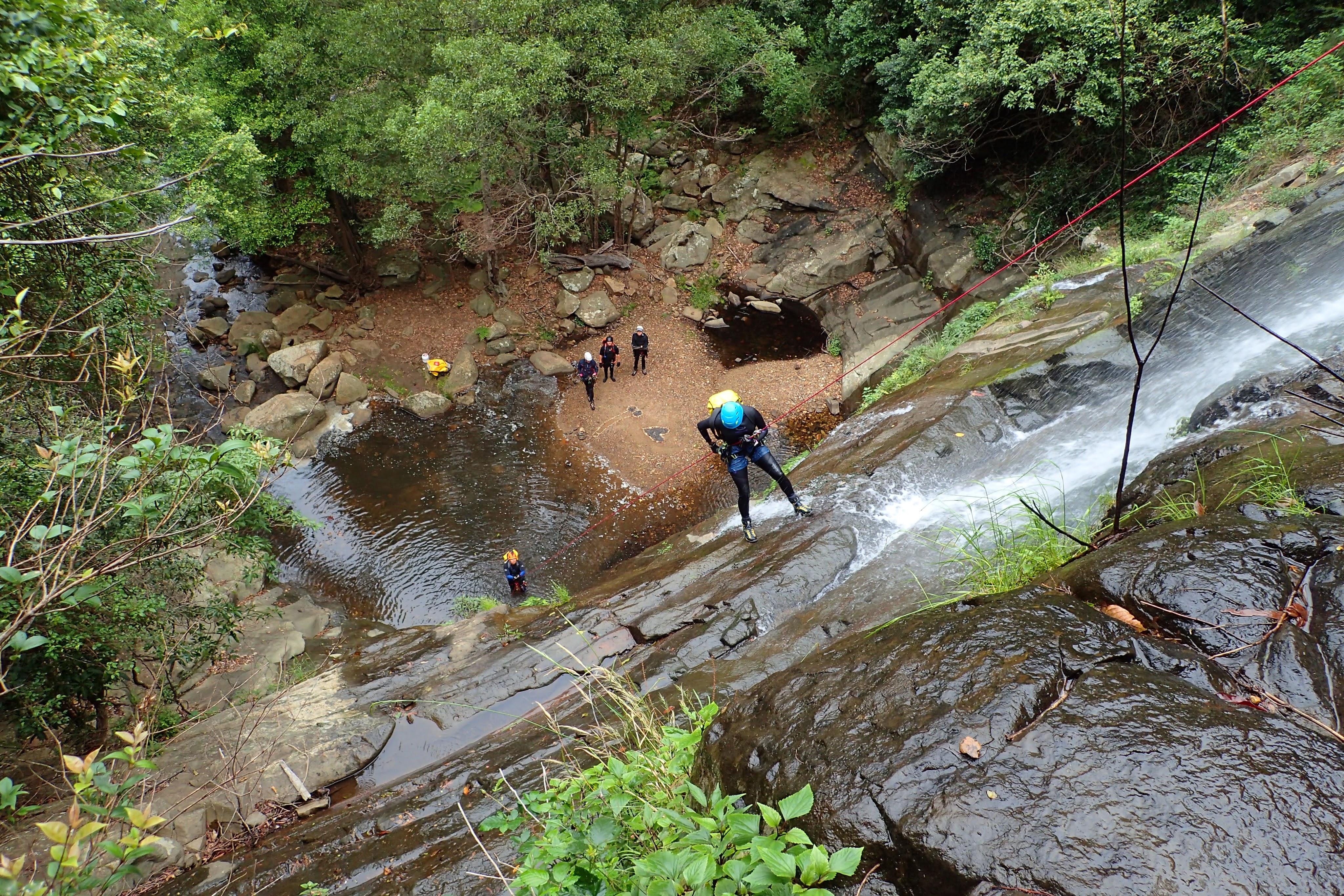
Once we’d gone over some theory, it was time to put everything into practice. Kirstie ran the first station using a Gigi. I climbed around the first drop taking photos which is why there are some odd angles.


P1 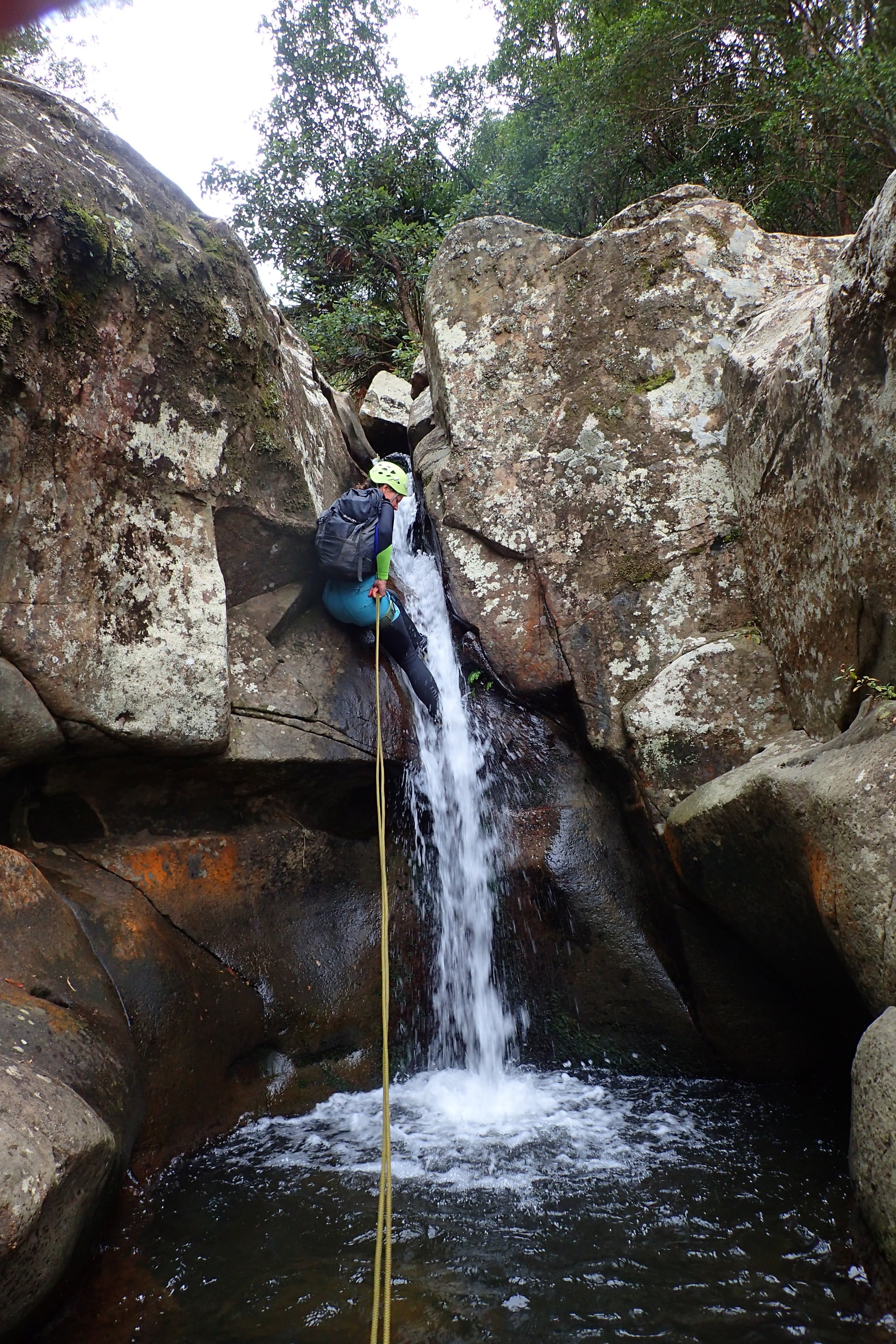
P1 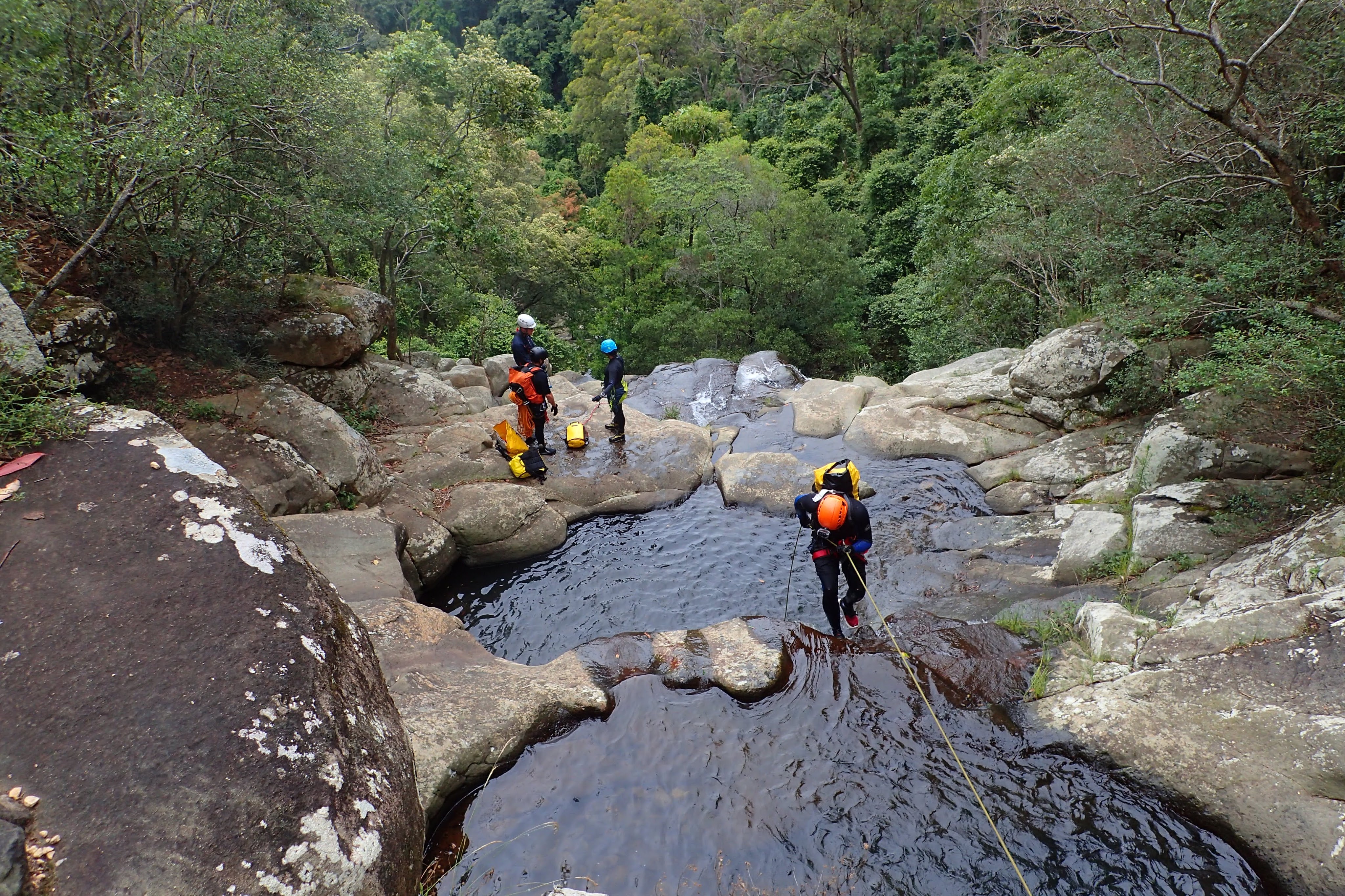
P1 
P1 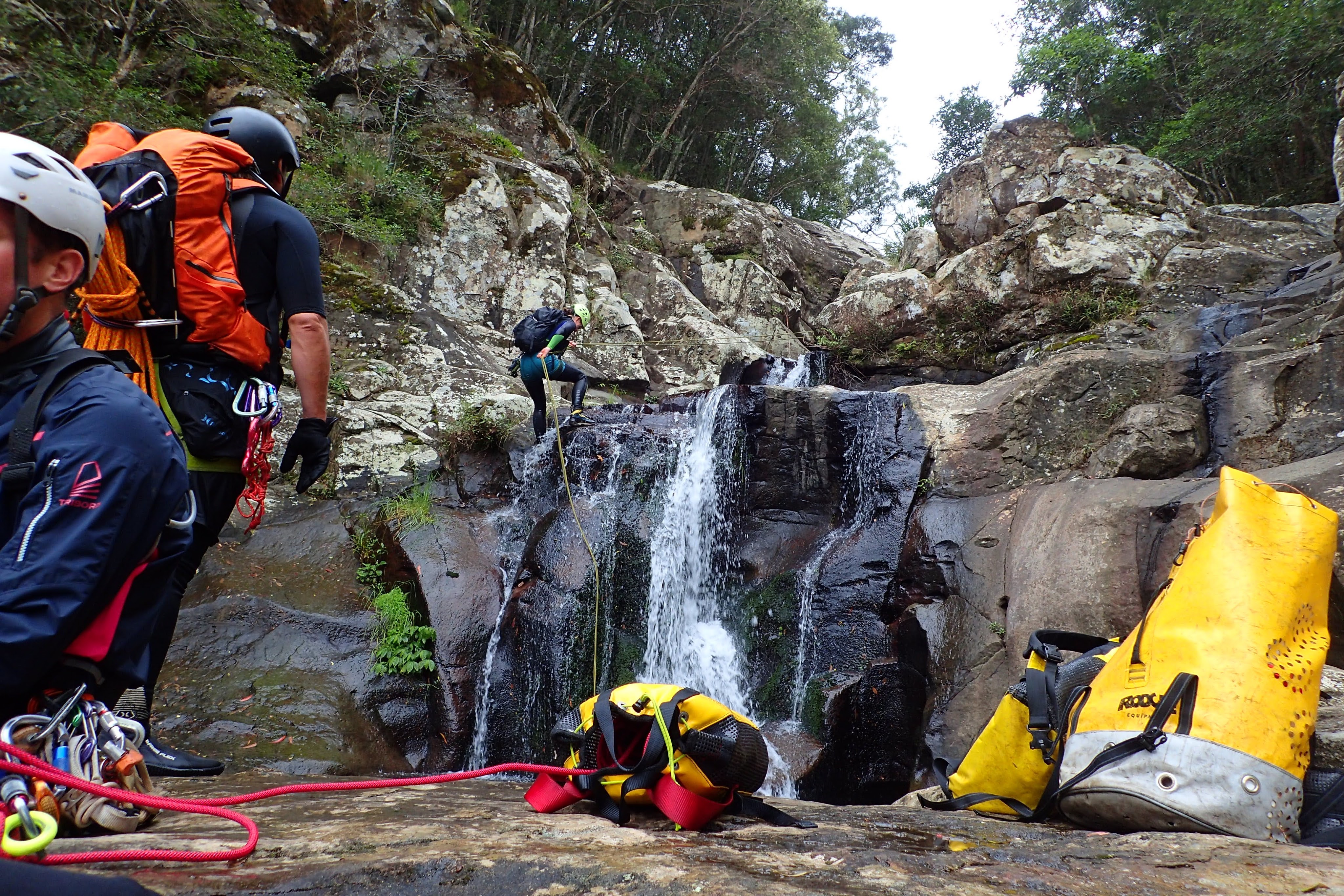
P1
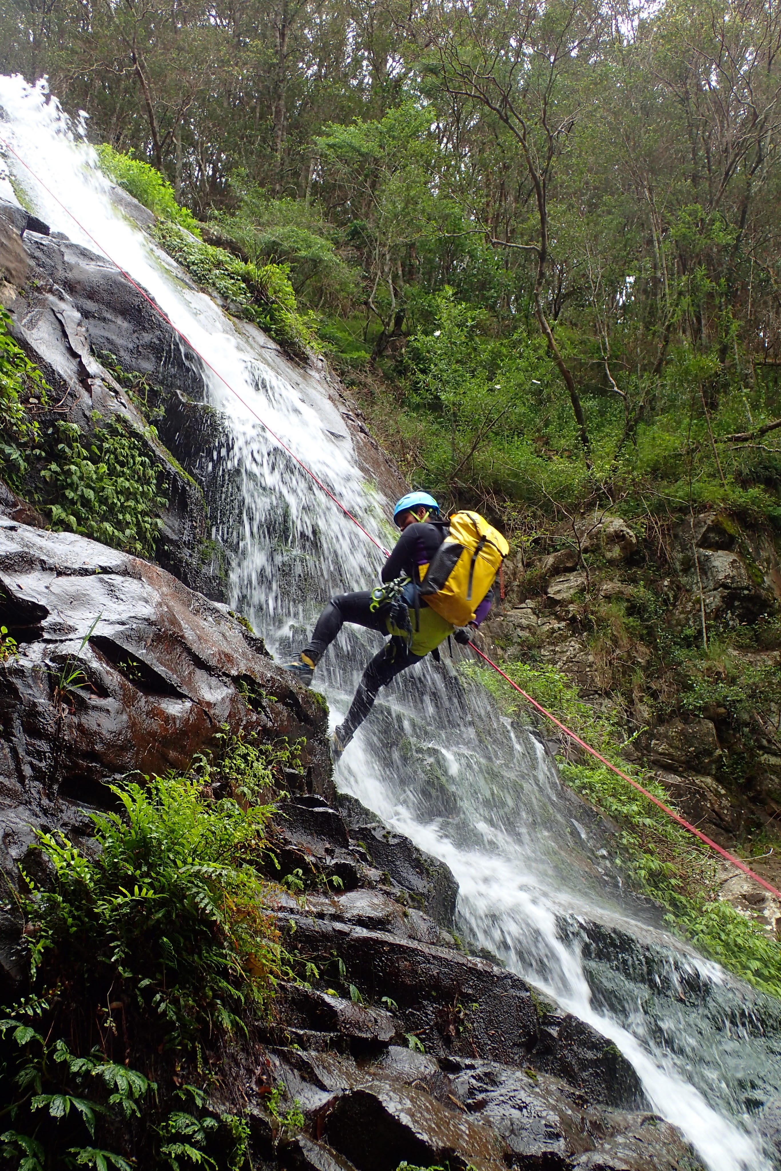
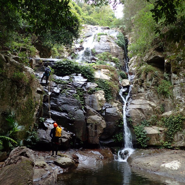
Yogi ran the next pitch using an releasable 8 block. I used a toggle to abseil down on the side. Pulling the rope to me I dislodged a large rock. I didn’t see where it came from exactly, but yelled out loudly. Luckily it missed. But it was close. I was a little rattled and sat on a ledge for a time…
P2
The last three drops use natural anchors. I think all trees. but my memory is hazy. Two shorter drops (one was very easy to walk around CR) and then a longer one to finish off (amazing tree roots – though you’ll have seen them on the way in as this is where the official track ends). I walked around the last drop to save a bit of time.
P4 
P5 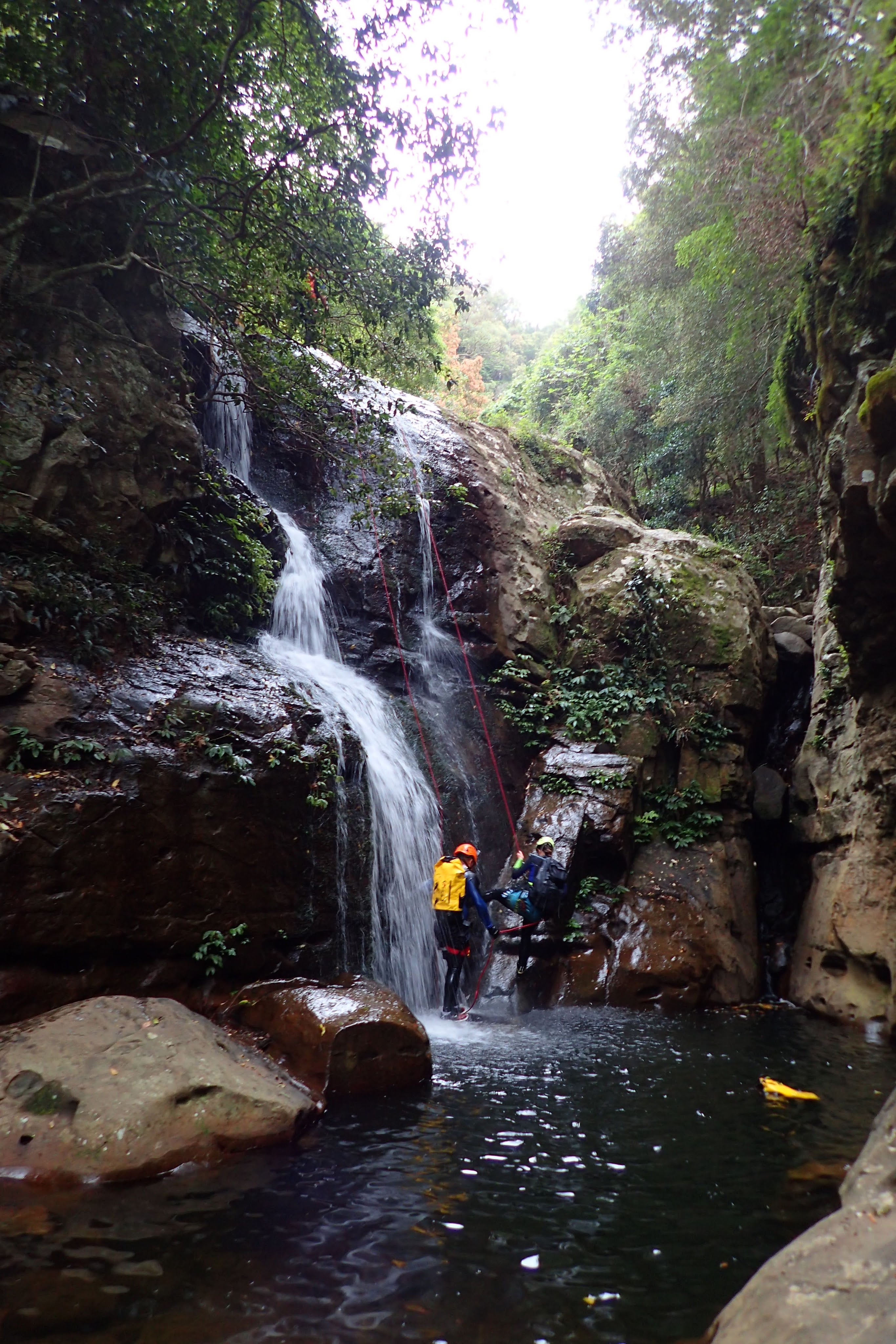
P6 (very easy walk around CR) 
P7 (I walked around CL)
It was then a short walk back to the car park. Kirstie had to go back to look after son, so I moved my things into Phil’s car. Some of us then went to the Robertson pub for dinner and from there to the Carrington Falls campground.
Thanks for a fun and informative day guys.
Thanks for all the knowledge Alex. And sorry for almost getting you with that rock…
Beta:
After the trip I wrote up these notes to help out an MSS trip that was planning to visit this spot.
The Cascades – Macquarie Pass National Park
Written by Felix Ossig-Bonanno
Summary:
Pitches: 7
Longest: 37m
Duration: a few hours
Quality: Very nice
Wetsuits: recommended as you will be in the water quite a bit, but prob not needed on a hot sunny day.
Access:
Start at the car park as if you are walking to the falls: https://goo.gl/maps/XUGHGyYNMdxXUQiQ7
Very quickly you will reach the bottom falls which is where most ppl walk to.
Crossing the stream via some stepping stones, you’ll easily locate a track that continues up the other bank. It is steep and slippery. You will pass a sign saying that the track is closed.
Follow this track up running parallel to the river almost all the way to the firetrail. The route starts when you encounter the second «track closed sign». About here: -34.56450, 150.67331
The Descent:
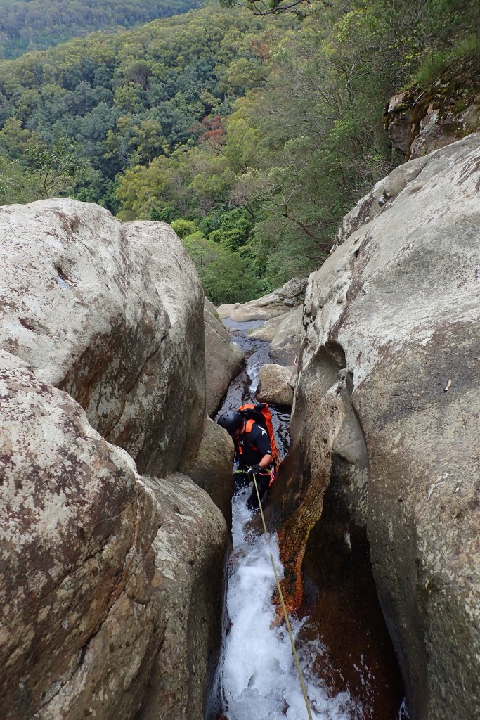
There isn’t really any canyon, but there are a series of 7 picturesque waterfalls. You can escape (or walk around) every drop, so it is a very non-committing mini trip. You can probably do the trip in about 3hrs, with a mixed party of about 6ppl.
The anchors for the pitches are a mixture of bolts and natural anchors.
Many of the pitches (and ck in general) are quite slippery.
P1 uses a chock stone in the middle of the ck. Its prob the hardest anchor to find. Abseil down through a series of cascading pools. <25m
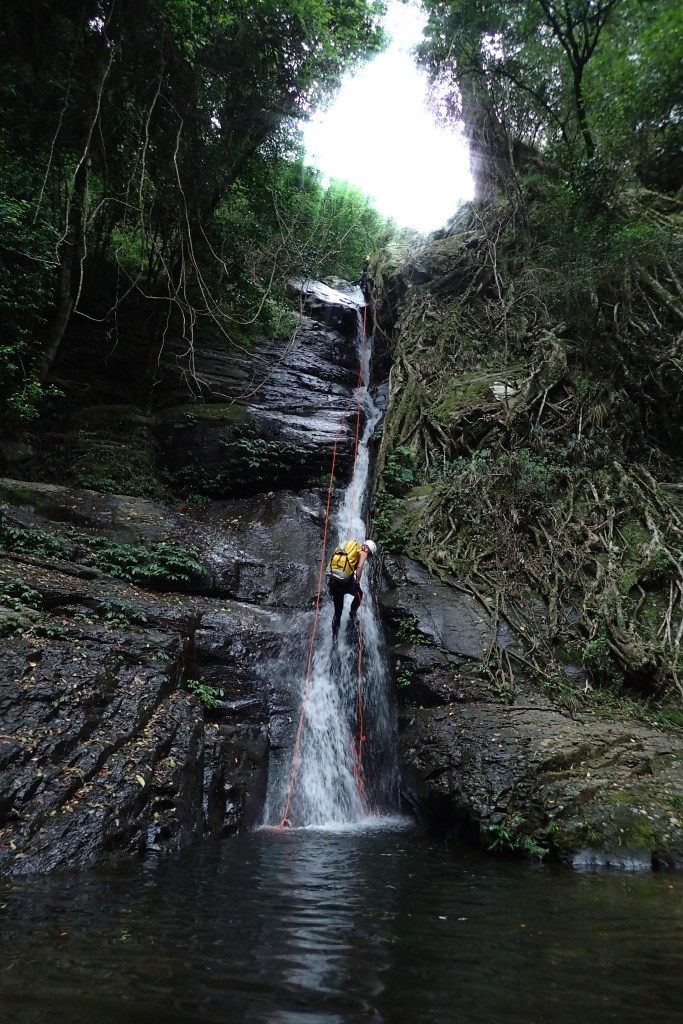
P2 is the longest pitch. It is bolted. 37m

P3 and P4 are also bolted.

The last three drops use natural anchors. I think all trees. but my memory is hazy. Two shorter drops and then a longer one to finish off (amazing tree roots – though you’ll have seen them on the way in as this is where the official track ends).
Exit:
The exit is very short and easy. Just reverse how you walked in.
